The Client
TDS Telecommunications LLC (TDS Telecom/TDS®) delivers high-speed internet, TV entertainment, and phone services to a mix of small to mid-sized urban, suburban and rural communities throughout the U.S. With 1.2 million connections, TDS is a rapidly growing technology company. Powered by fiber-optics and new industry-leading technologies, TDS delivers up to 8 Gigabit internet speeds and offers internet-protocol based TV entertainment solutions along with traditional phone services. TDS also offers businesses VoIP advanced communications solutions, dedicated internet service, data networking, and hosted-managed services.
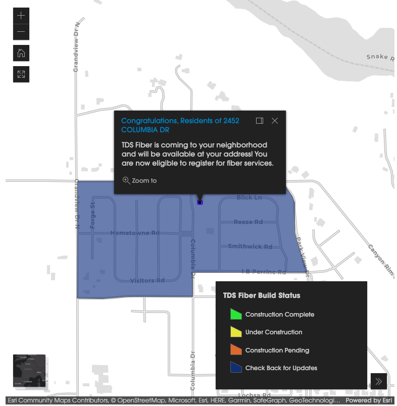
TDS Fiber is a subsection of TDS Telecom which provides fiber network services to rural and suburban communities. During the time of this project, TDS Fiber was mostly in a pre-launch stage, so there was a dedicated status section for prospective customers to check on their community to see the build status of fiber optic network in their area.
The Challenge
Prior to the use of GIS maps, the status pages of TDS Fiber would display a static image of the area the user was searching for. This caused a number of issues for both the end-user and behind the scenes within the company.
- Maps on TDS Fiber showing the status of builds in dedicated fiber networks/neighborhoods (DFN) could not update in real-time.
- Time and budgets were used towards having a dedicated associate resize and upload maps for every DFN—this work could take days or weeks before the updates were implemented.
- Because of these time-consuming updates, maps on the front-end could be out-of-date for a number or days, or even weeks.
The Solution
Implementing GIS maps for these status pages was the logical solution for this challenge. Four software engineers from the IT team who specialized in user experience, as well as one web designer from the digital operations team within the marketing department, were tasked to create a GIS map that accomodated for all the possible addresses within the TDS Fiber management system and could be placed on the status pages on TDS Fiber. These maps would be custom based on the address the user entered to view this page. If the map could not display for whatever reason (browser incompatibility, the speed of the user's internet, etc.), a message would display to the user with information on other methods to obtain the status of the build of their neighborhood.
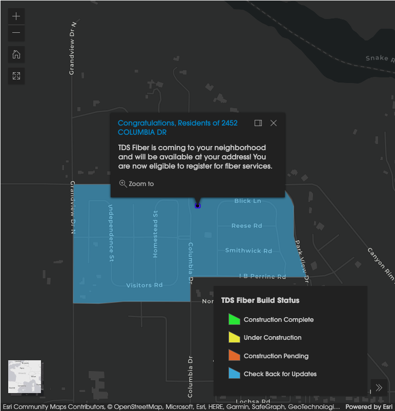
My role in this project was to design the look and feel of the map, as well as adhere to accessibility guidelines. I chose the color scheme for the map, the font and font size, the colors for the map legend symbols, and suggested the implementation of light and dark mode that can be toggled in real-time. I was also responsible for the code placement of the map on the actual page.
The Results
Because of this solution:
- The end-user could now get up-to-the-minute information about their DFN;
- The maps were now interactive and could be adjusted to the user's preferred settings;
- The need to have a dedicated associate internally to update static images of the maps was eliminated, saving both time and money for TDS.
This project earned the team an internal "Inspiring Excellence Award" in 2022.